")


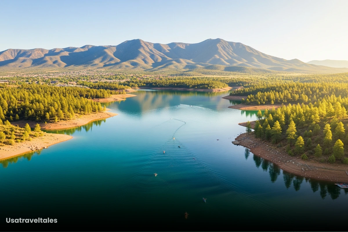
What makes Usery Mountain Regional Park so special? Accessibility and affordability. As I was researching this article, I was pleasantly surprised to learn that you only pay a single park entrance fee (typically $7 per vehicle) to unlock access to all its fantastic trails.
If you’re arriving on foot, by bike, or horseback, there’s a small per-person fee (around $2), but once inside, the entire network of trails is yours to explore without additional charges.
This commitment to affordable outdoor access truly makes Usery Mountain a standout destination.
Table of Contents
My Goal with This Post
My goal with this post is to provide you with a comprehensive, up-to-date, and genuinely helpful guide to the best hiking trails in Usery Mountain Regional Park.
Through detailed research, including checking current park fees and recent trail conditions, I’ve aimed to distill the most essential information to help you plan an unforgettable outdoor adventure.
I’ll share insights gained during my “research journey” to make this guide feel as if a friend is giving you their best advice.
How These Trails Were Selected?
Choosing the “best” hikes can be subjective, but for this guide, I focused on several key criteria to ensure a well-rounded and valuable resource for you:
1. We wanted to include trails for every hiker, from absolute beginners and families with young children to those seeking a moderate challenge. This ensures there’s something for everyone to enjoy safely.
2. Each selected trail offers unique and breathtaking views.
3. Trails frequently praised by other hikers and consistently well-regarded in online communities were prioritized. This indicates a high level of visitor satisfaction.
4. Trails that are easily reachable within the park and those that cater to multiple activities (hiking, biking, horseback riding) offer greater flexibility and appeal to a broader audience.
5. Some trails were chosen for their ability to connect with others, allowing experienced hikers to create custom, extended routes.
By using these criteria, I aimed to curate a list that represents the best and most accessible experiences Usery Mountain Regional Park has to offer.
Wind Cave Trail
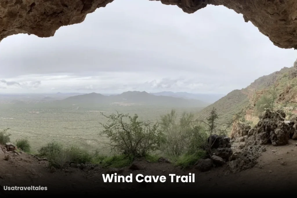
Trail Info:
- Trail Length: Approximately 3 miles round trip
- Elevation Gain: Around 800 feet
- Estimated Time: 1.5 to 2.5 hours round trip
The Wind Cave Trail is arguably Usery’s most famous and popular hike.
The path is generally well-maintained but does involve rocky sections and a steady incline, especially as you approach the top.
Blevins Trail
Trail Info:
- Trail Length: Approximately 3.1 miles (5 km) loop
- Elevation Gain: Around 119 feet (36 meters)
- Estimated Duration: About 1 to 1.5 hours to complete the loop
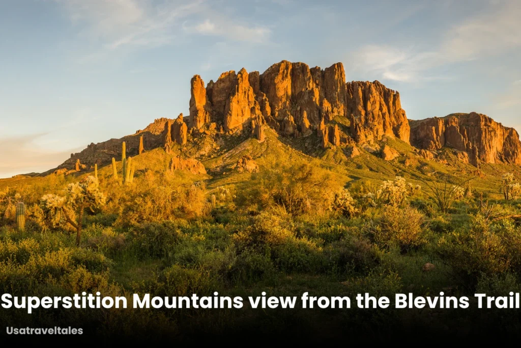
When I researched the Blevins Trail, its reputation for accessibility immediately stood out. This relatively flat and well-marked loop is a favorite for good reason: it’s ideal for beginners, families with children, and anyone seeking a leisurely hike.
You’ll enjoy expansive views of Pass Mountain, Cat Peaks, and the iconic Superstition Mountains. I often recommend trails like Blevins to friends new to desert hiking because it’s a perfect introduction without overwhelming challenges.
Beyond hiking, Blevins Trail is a multi-use path popular for trail running, mountain biking, and horseback riding.
Suggestion: 7 Easy Waterfall Hikes in Arizona for Beginners and Families
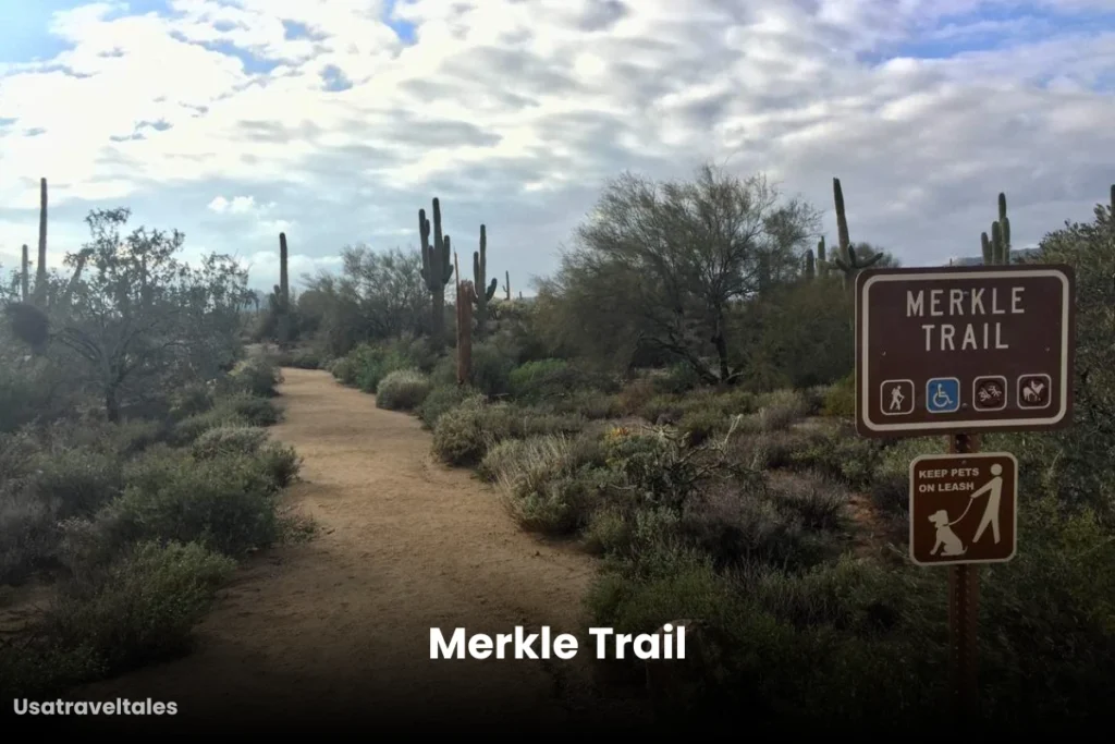
Merkle Trail
Trail Info:
- Trail Length: Approximately 1 mile (1.6 km) loop
- Estimated Duration: Around 20–30 minutes to complete the loop
The Merkle Trail truly embodies the “short and sweet” hiking experience in Usery Mountain Regional Park.
It’s a perfect option if you’re short on time.
This is a barrier-free trail, making it accessible for a wider range of visitors.
Suggestion: Famous Trails of Usery Mountain Regional Park
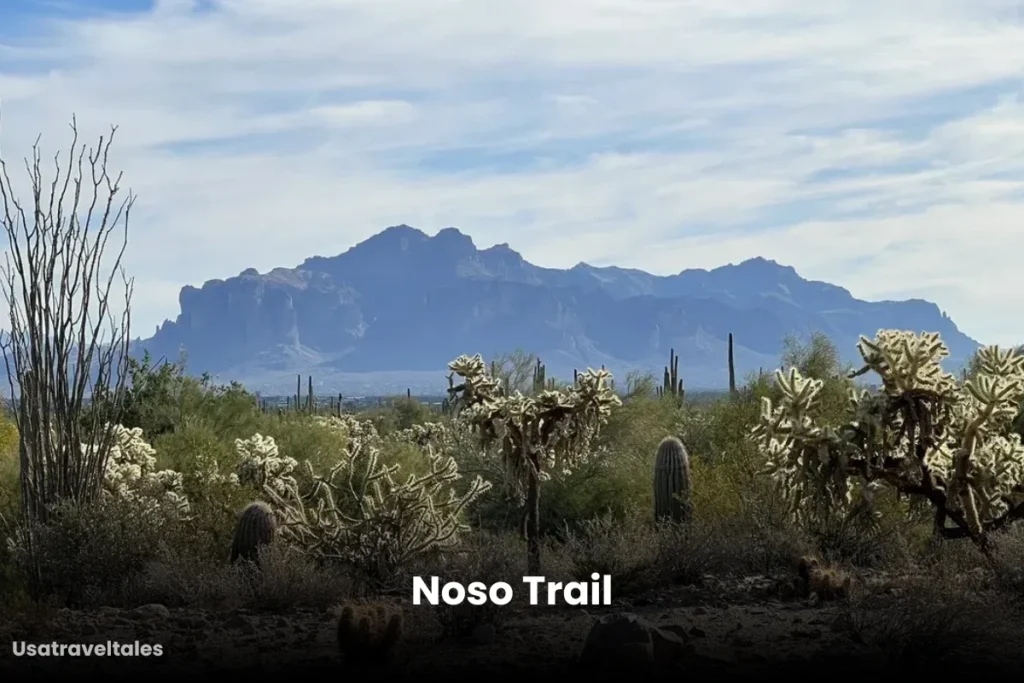
Noso Trail
Trail Info:
- Trail Length: Approximately 1.1 miles (1.7 km) one-way
- Elevation Gain: About 115 feet (35 meters)
- Estimated Duration: Around 20–30 minutes to complete
What fascinated me during my research about Noso was its connectivity. It’s not just a standalone trail; it intersects with other paths like the Blevins and Channel Trails.
This feature is incredibly valuable for hikers who enjoy customizing their outings, allowing for extended adventures or varied loops.
Like Blevins, Noso is a shared-use trail, welcoming hikers, mountain bikers, and horseback riders.
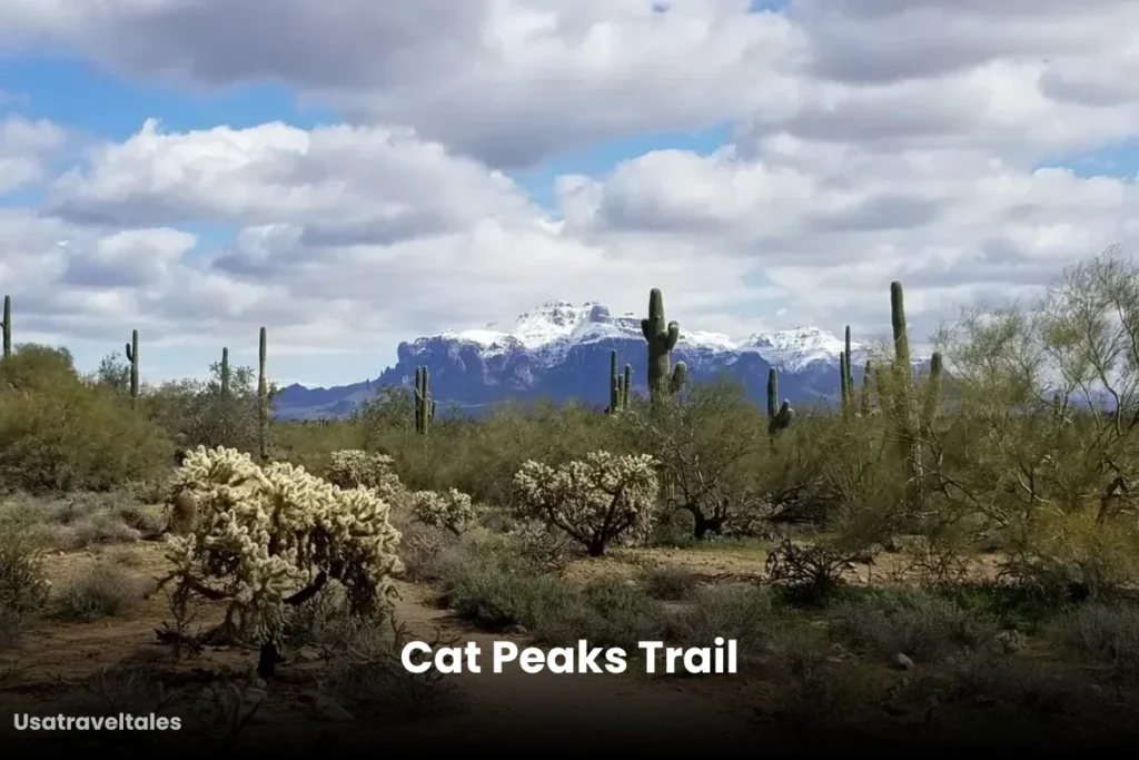
Cat Peaks Trail
Trail Info:
- Trail Length: Approximately 2.7 miles (4.3 km) loop
- Elevation Gain: Around 125 feet (38 meters)
- Estimated Duration: About 1 to 1.5 hours to complete the loop
This loop provides truly stunning panoramic views of the Superstition Mountains, the rugged Goldfield Mountains, and Pass Mountain.
While generally accessible, my research indicated that certain sections, particularly near the Cat Peaks Pass, involve steeper inclines and rockier terrain.
This makes it a great choice for hikers looking for a moderate challenge with significant visuals.
Hawes Trail System
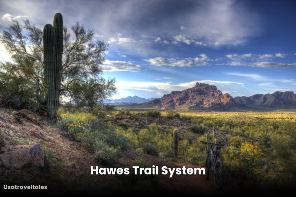
Hawes trail system includes:
- Over 85 mountain biking trails
- Over 81 hiking and trail running trails
- 10 equestrian trails
While not strictly within the core Usery Mountain Regional Park boundaries, the Hawes Trail System is an incredibly popular adjacent network that frequently comes up in conversations about East Valley trails, and often integrates with Usery’s offerings.
It is primarily celebrated by mountain bikers for its extensive and well-maintained singletrack. However, it’s crucial to remember that these trails are also open to hikers and trail runners.
The Hawes Trail Alliance does a phenomenal job with regular maintenance, ensuring a top-notch experience.
While Usery Mountain Regional Park has its own entrance fee, some parking areas for the Hawes Trail System, especially those on Tonto National Forest land, may require a Tonto Daily Pass.
This is a separate fee from the Usery Mountain entrance fee. Always check the signage at the trailhead before you head out.
Ridge Trail

Trail Info:
- Trail Length: Approximately 1.8 miles (2.9 km)
- Elevation Gain: Around 242.7 feet (74 meters)
- Estimated Duration: About 30–45 minutes to complete
These iconic Arizona landmarks truly stand out from the higher vantage points along the ridge. It’s a perfect trail for a quick but impactful dose of desert scenery.
Its prime feature is the unobstructed vistas it provides of Red Mountain and Four Peaks.
Conclusion
If you’re a beginner or looking for a leisurely hike with beautiful desert scenery, Blevins Trail and Noso Trail are perfect choices as both of them are relatively flat, accessible, and family-friendly.
For those seeking moderate challenges with rewarding views, Wind Cave Trail, Cat Peaks Trail, and Ridge Trail provide a great balance of elevation and stunning panoramas.
If you’re short on time or prefer a quick, easy hike, Merkle Trail offers a small but enjoyable loop. And for adventure seekers, particularly mountain bikers, the extensive Hawes Trail System offers endless opportunities.
Share this content: