
")


All trails are free to use, and there are no special permits required to hike or bike on these trails.
Parking is generally free at trailheads mentioned.
All the trails we mentioned in this post class 1 e-bikes are allowed there which provide pedal-assist up to 20 mph.
Table of Contents
Location & Access

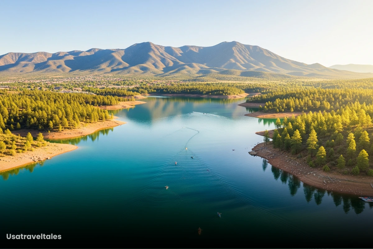
The Hawes Trail System is located in the desert area between the Salt River and the Usery Mountains in Mesa, Arizona.
Main Trailheads & Access Points
There are a total of six main trailheads and access points, of which two are under construction.
Most trails start or connect at the Bush Highway Trailhead.
Bush Highway Trailhead
- Location: Accessible via Bush Highway, near the intersection with Power Road.
- Features: Provides entry to several popular trails, including the Ridge and Saguaro Trails.
- Parking: Free parking available; however, it’s recommended to arrive early, especially on weekends, as spaces can fill up quickly.
Usery Mountain Regional Park
- Location: Approximately 15 minutes north of downtown Mesa.
- Features: Offers a variety of trails suitable for hiking and biking, with connections to the Hawes Trail System.
- Parking: Parking is covered by the $7 daily fee, which grants access to the park’s facilities.
Power Road Access
- Location: Behind the Walgreens at Power Road and Thomas Road.
- Features: Provides access to the Fenceline Trail and other connecting routes.
- Parking: Free street parking is available; be mindful of local regulations and signage.
Granite Reef Recreation Area
- Location: Along the Salt River, accessible via Bush Highway.
- Features: Offers scenic views and access to the Hawes Trail System.
- Parking: Requires a Tonto Day Pass ($8); it’s advisable to check current regulations and fees before visiting.
Red Mountain Access
- Location: Located farther north on Usery Pass Road.
- Features: Provides access to additional trails within the Hawes Trail System.
- Parking: Planned parking lot with a capacity of 75 to 100 cars; currently awaiting construction.
Usery Pass Road Access
- Location: On the west side of Usery Pass Road, north of Usery Mountain Regional Park.
- Features: Provides access to the Hawes Trail System via the Bob Gnarly Trail.
- Parking: Approved parking lot with a capacity of 150 to 200 cars; construction pending.
Selection Criteria of These Trails
As of 2025, all the following trails are considered popular and well-regarded within the Hawes Trail System in Mesa, Arizona, especially among local mountain bikers and experienced trail users:
Top 9 Trails of the Hawes Trail System
1. Red Mountain Rush

Overview:
Red Mountain Rush is a fun and fast mountain bike trail that goes downhill along a ridge.
It mixes natural paths with built-up turns and jumps.
Distance & Elevation:
- Length: 3.0–3.5 miles
- Elevation Loss: Around 400-500 ft (downhill)
- Estimated Ride Time: 10–20 minutes downhill
Trail Type: Multi-use (mountain biking and hiking), primarily downhill ride
Access: Bush Highway Trailhead or Wildhorse Parking Area (free parking)
Connections: Loops with Twisted Sister and Big Sister trails
2. Big Sister

Overview:
Big Sister is a fast and exciting trail with banked turns, small hills, and some drops.
Distance & Elevation:
- Length: 2.7–3.0 miles
- Elevation Loss: 500-600 ft
- Ride Time: 10–15 minutes fast ride
Trail Type: Primarily mountain biking, downhill flow
Access: Bush Highway Trailhead (free parking)
Connections: Loops with Twisted Sister and Red Mountain Rush
3. Twisted Sister
Overview:
Twisted Sister is mostly known as the main uphill path to reach Big Sister and other trails higher up. It’s a winding singletrack that has a nice balance of climbing and smooth riding.
Distance & Elevation:
- Length: 3.0–3.5 miles
- Elevation Gain: 350-450 ft uphill
- Time: 20–40 minutes climb
Trail Type: Mountain biking and hiking
Access: Bush Highway Trailhead
Connections: Key connector to Big Sister and Red Mountain Rush
4. Sunset Ridge
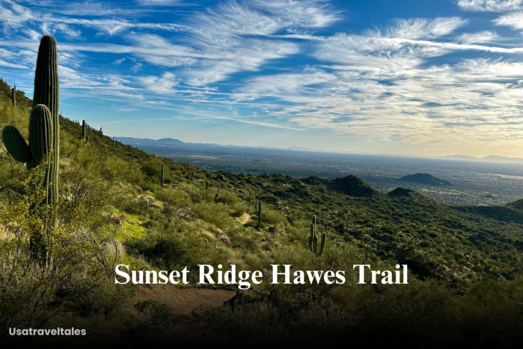
Overview:
Sunset Ridge is a really tough trail marked as double black diamond. It has steep, rocky turns and tricky sections that challenge even expert riders.
Distance & Elevation:
- Length: 2.0–2.5 miles
- Elevation Change: 400-500 ft
- Time: 15–30 minutes, technical pace
Trail Type: Mountain biking
Access: Usery Pass Trailhead or Bush Highway Trailhead
Connections: Links to Ridge Trail (#59)
5. Boulderdash

Overview:
Boulderdash is a rough and tricky trail full of rocky patches and big drops.
Distance & Elevation:
- Length: 1.5–2.0 miles
- Elevation Loss: 200-300 ft
- Time: 10–20 minutes, technical pace
Trail Type: Mountain biking
Access: Bush Highway Trailhead
Connections: Connects with Sunset Ridge for technical loops
6. Secret Trail
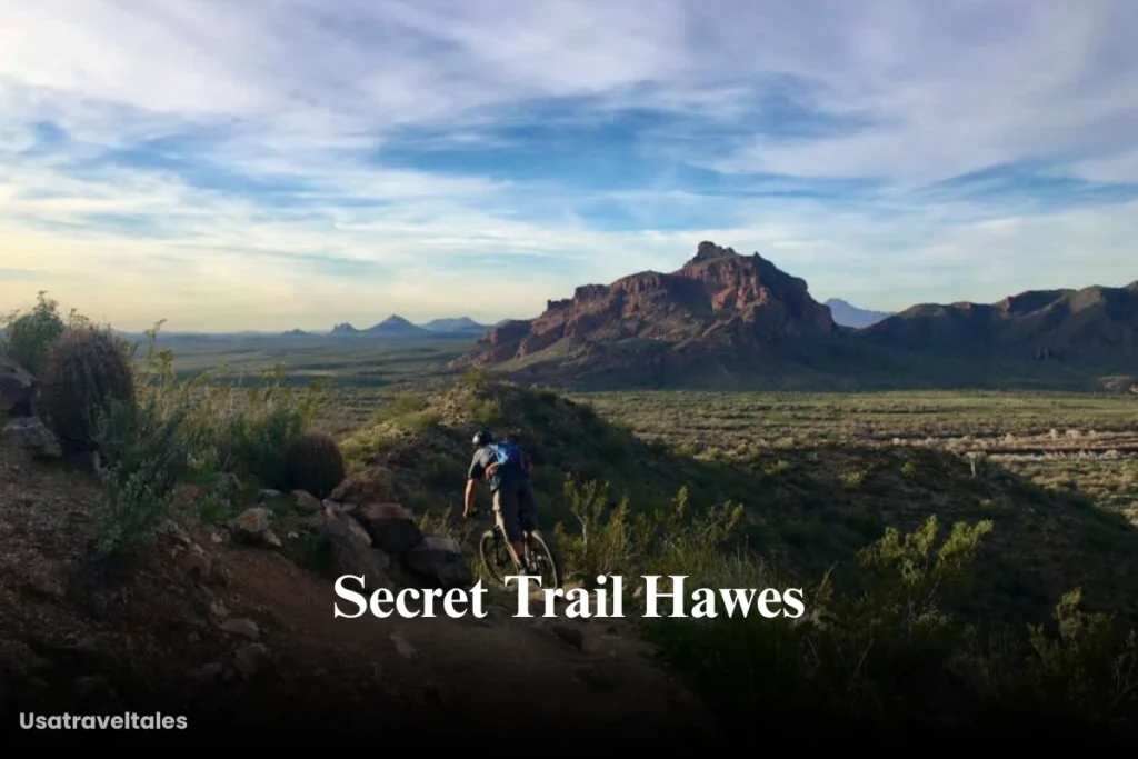
Overview:
It is a single track trails which offers Sonoran Desert landscapes.
Distance & Elevation:
- Length: 1.6–2.0 miles
- Elevation Gain: 150-250 ft
- Time: 15–30 minutes ride or hike
Trail Type: Multi-use hiking and biking
Access: Bush Highway Trailhead
Connections: Connects with Saddle Trail (#51) and Mine Trail
7. Mine Trail (Saguaro Trail / Mine Shaft)
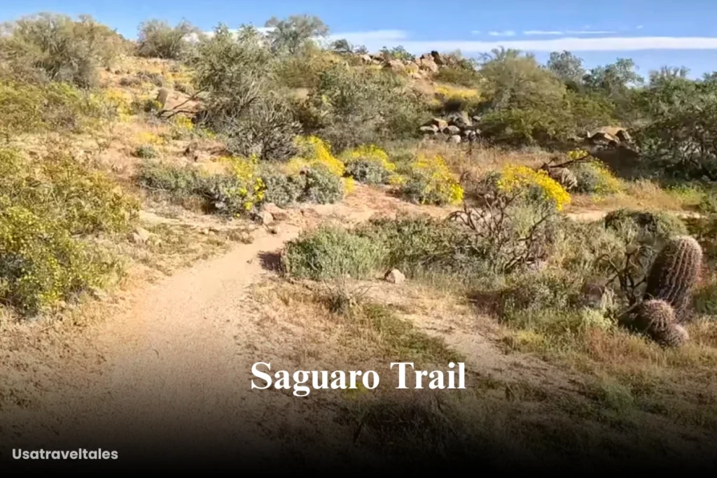
Overview:
A diverse trail combining desert views with steep, technical switchbacks and the unique “Mine Shaft” rock formation.
Distance & Elevation:
- Length: 2.7–3.0 miles
- Elevation Change: 300-400 ft
- Time: 20–40 minutes, technical sections
Trail Type: Multi-use hiking and biking
Access: Bush Highway Trailhead
Connections: Links with Ridge Trail and Secret Trail
8. Ridge Trail (#59)
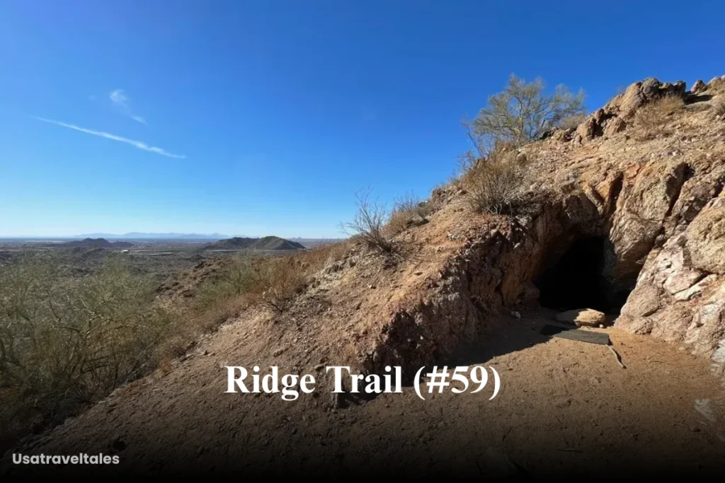
Overview:
A key backbone trail through the Hawes network, Ridge Trail offers sustained climbs, ridge-top views, and technical sections.
Distance & Elevation:
- Length: 3.0–3.5 miles
- Elevation Change: 400-600 ft
- Time: 20–40 minutes ride
Trail Type: Multi-use hiking and biking
Access: Bush Highway or Usery Pass Trailheads
Connections: Connects Sunset Ridge, Mine Trail, Secret Trail
9. Dirt Therapy

Overview:
A modern, flow trail built for fun with berms, rollers, and jump lines offering a playful riding experience.
Distance & Elevation:
- Length: 1.8–2.0 miles
- Elevation Loss: 150-250 ft
- Time: 5–10 minutes fast ride
Difficulty: Intermediate
Trail Type: Mountain biking
Access: Bush Highway Trailhead
Connections: Loops with Twisted Sister and other lower trails
Conclusion
The Hawes Trail System continues to evolve, but these nine trails represent the most exciting and well-regarded routes as of 2025.
Share this content:

One thought on “Hawes Trail System in Mesa, Arizona”